
Santa Teresa Costa Rica Map: The Surf Breaks, Cheap Eats and ATMs I Use (+ Free Printable)
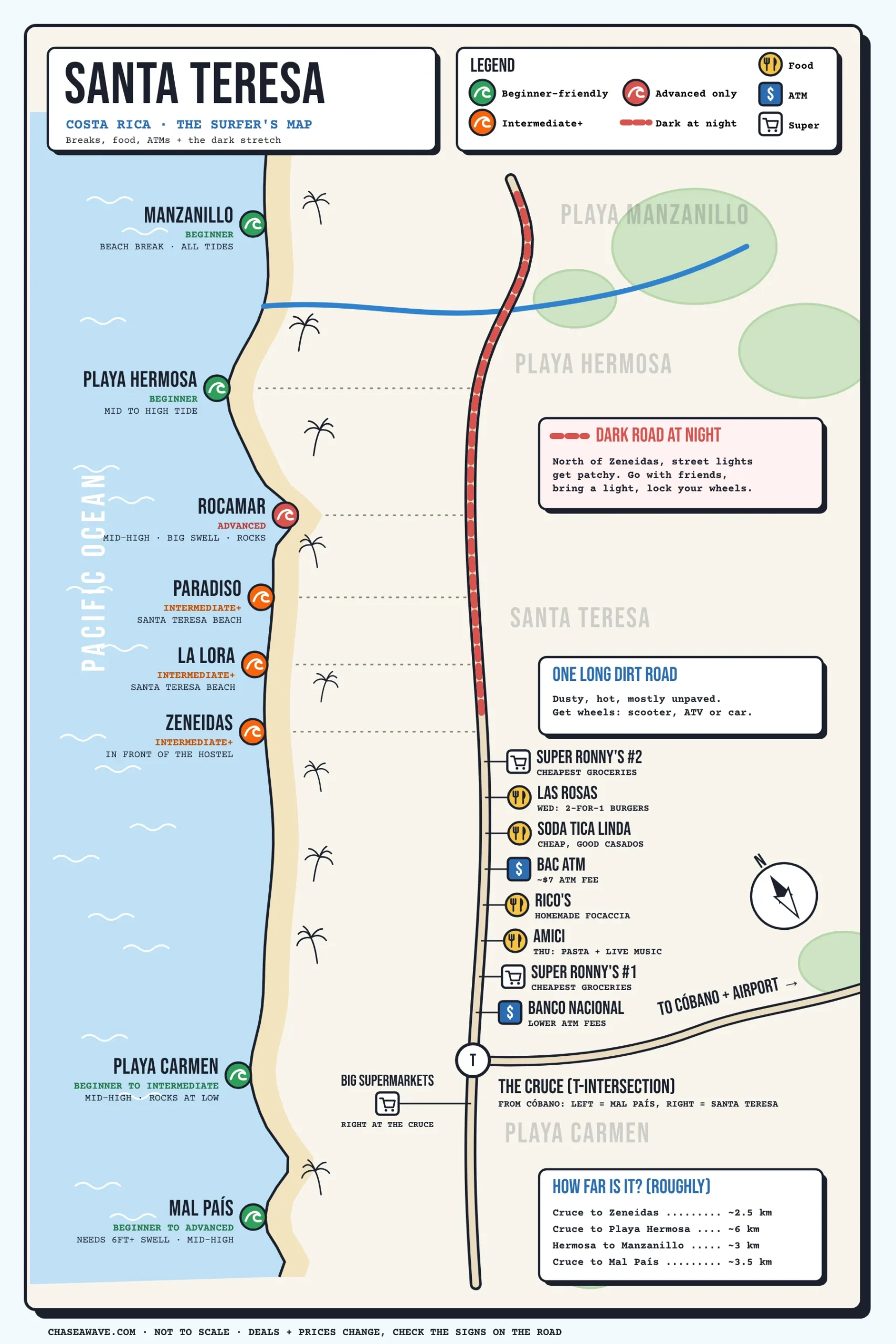
I spent almost four months in Santa Teresa, and here’s what nobody tells you before you arrive. The whole town is basically one long road with the ocean on one side. Once that clicks, getting around gets a lot easier.
So I made the Santa Teresa Costa Rica map I wish I’d had on day one. It shows every surf break from Manzanillo down to Mal País, the cheap places I actually eat, the ATMs, the supermarkets and the stretch of road I’d avoid alone at night. For the waves themselves, my Santa Teresa surf guide goes deeper.
The map is free right here on the page. If you want the printable version plus my Google Map with all my pins, drop your email below the map and I’ll send it over.
TL;DR: Santa Teresa Costa Rica Map
- The layout: one long main road along the coast, paved through town and dirt north of Zeneidas. Manzanillo and Playa Hermosa up north, Santa Teresa in the middle, then the cruce (T-intersection) at Playa Carmen, and Mal País to the south.
- Beginner breaks: Playa Hermosa, Playa Carmen (mid to high tide) and Manzanillo. Book a surf lesson for your first sessions.
- Advanced only: Rocamar. It needs a bigger swell and more water over the rocks.
- Mal País: beginner to advanced, depending on the swell. It only wakes up on a 6 ft+ swell, but the waves there stay smaller than the rest of town.
- Cheap food: sodas. A casado costs about 5,000 to 6,000 colones.
- Cash: BAC charges about $7 a withdrawal. Banco Nacional at the cruce is cheaper.
- Where to stay: central or north Santa Teresa if you surf. I stayed at Zeneidas Surf Garden for a month.
- Watch out for: the dark road north of Zeneidas at night.
Heads up: some links in this post are affiliate links. If you book through them, I earn a small commission at no extra cost to you. 🤙
My Santa Teresa Costa Rica Map (Free to Use)
Here it is. Tap the map to open it full size and zoom in. When you’re done, hit the close button (or your phone’s back button) to come back to the post. North is toward the top, and the coast runs from Manzanillo down to Mal País.
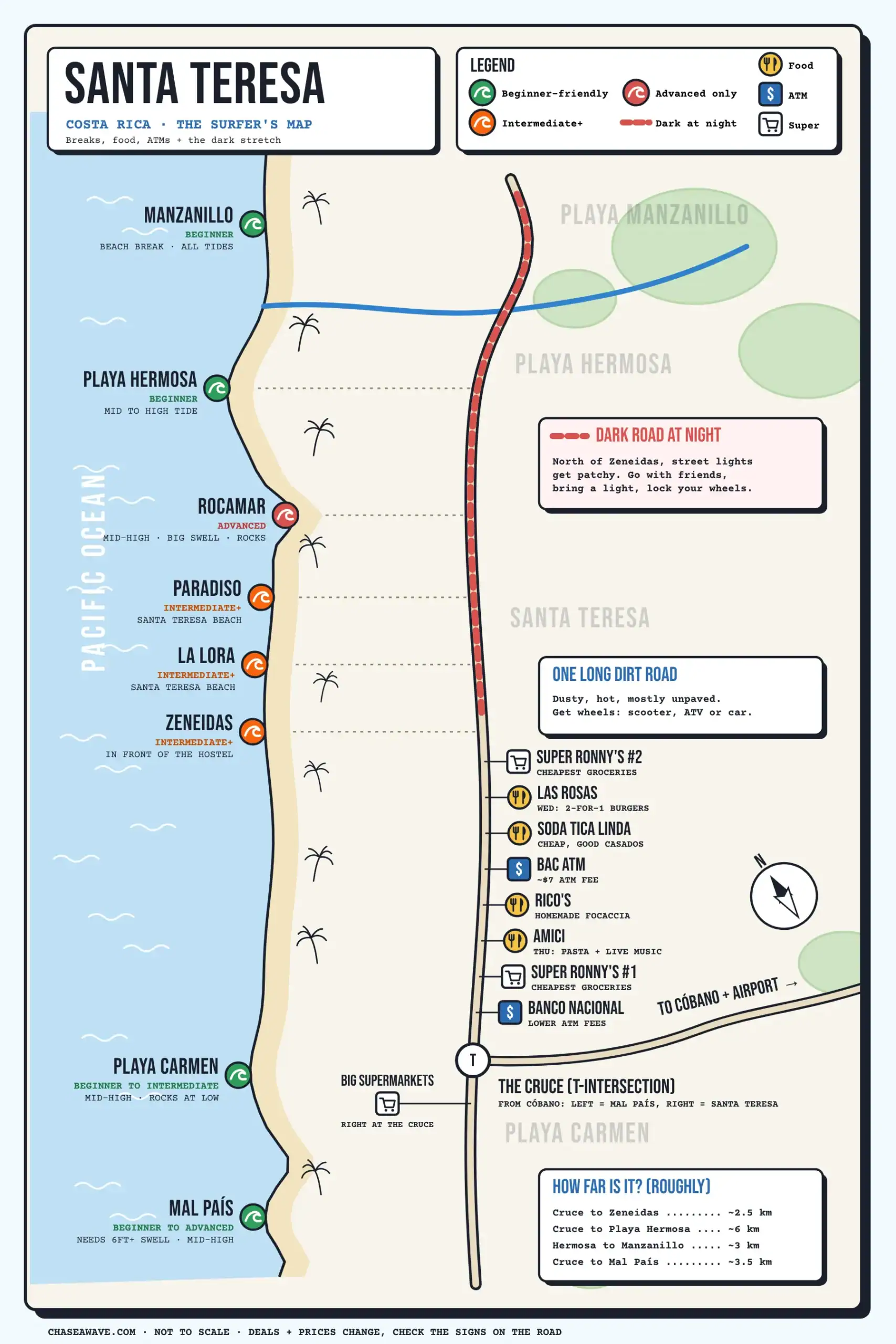
A quick key. Green waves are beginner-friendly, orange are for intermediate surfers and up, and red are for advanced surfers only. Yellow pins are food, blue “$” pins are ATMs, and the cart pins are grocery stores.
📍 Get the printable map + my Google Map
Want it offline? I’ll email you the hi-res printable version with a one-page cheat sheet (breaks by tide, deals, ATMs), plus my personal Google Map with every pin I’ve saved in town. Free, and no spam.
How Santa Teresa Is Laid Out
The area layout is simple once you see it. Everything hangs off one main road that runs parallel to the beach. Little sandy lanes branch off toward the ocean, and those are your beach access points.
The key landmark is the cruce, the T-intersection at Playa Carmen. Coming in from Cóbano, you hit the cruce. Turn left for Mal País. Turn right for Santa Teresa, and keep going north for Playa Hermosa and Manzanillo. From the cruce to the north end of Playa Hermosa is about 6 to 7 kilometers.
The road is paved all through town, from the cruce up to the Zeneidas hostel, and from the cruce down to Mal País. North of Zeneidas, toward Playa Hermosa and Manzanillo, it turns into a dirt road. It’s dusty in the dry season and muddy when it rains.

| Area | Where it is | Good for |
|---|---|---|
| Manzanillo | Far north, past a rough road and a river | Empty beach, mellow beach break |
| Playa Hermosa | North, about 6 km from the cruce | Beginner lessons, quieter stays |
| Santa Teresa | The middle, from Rocamar down to the town center | The main peaks, food, nightlife |
| Playa Carmen | At the cruce | Banks, supermarkets, beginner waves |
| Mal País | South of the cruce | Quiet, rocky coast, a reef break on bigger swells |
Getting here from the airport? I break down the routes in how to get to Santa Teresa from San José.
Surf Breaks on the Map, North to South
These are the breaks on my map, in order from north to south. The tide matters a lot here, so always check it before you pick a spot.
| Break | Level | Best tide | Watch out for |
|---|---|---|---|
| Manzanillo | Beginner | All tides | Far from town, rough road |
| Playa Hermosa | Beginner | Mid to high | Harder at low tide |
| Rocamar | Advanced | Mid to high, bigger swell | Rocks and reef |
| Paradiso | Intermediate+ | Low to mid | Strong rips, dumpy shorebreak |
| La Lora | Intermediate+ | Low to mid | Strong rips, dumpy shorebreak |
| Zeneidas | Intermediate+ | Low to mid | Strong rips, dumpy shorebreak |
| Playa Carmen | Beginner to intermediate | Mid to high | Rocks show up at low tide |
| Mal País | Beginner to advanced (depends on swell) | Mid to high, 6 ft+ swell | Exposed reef at low tide |

Manzanillo and Playa Hermosa (North)
Manzanillo is a beach break that works on all tides, and it’s a good beginner spot. I’ll be honest, I’ve never surfed it myself. It’s out of the way, so most people only go for a day trip.
Playa Hermosa is where I send beginners. It works best from mid to high tide. It still works at low tide, but it gets a bit more challenging. A lot of surf schools teach here, and for a good reason.
Why beginners love Hermosa
The beach at Playa Hermosa is really wide and really long. So the waves break more gradually instead of dumping straight onto the sand like they do at Playa Santa Teresa. That’s exactly what you want when you’re learning.
Rocamar, Paradiso, La Lora and Zeneidas (Santa Teresa)
Just south of Playa Hermosa is Rocamar. It’s a very challenging break that only works from mid to high tide and on certain swells. You usually need a bigger swell. It breaks in front of a pile of rocks and reef, which is where the name comes from. Not a beginner spot at all.
Then you hit Playa Santa Teresa itself, with three peaks: Paradiso, La Lora and Zeneidas, which breaks right in front of the Zeneidas hostel. La Lora is the one I surf the most. Low to mid tide is my pick for the best surf here. My best time to surf Santa Teresa post has the season-by-season breakdown.
Playa Carmen and Mal País (South)
Playa Carmen is great from mid to high tide and good for beginners to intermediate surfers. At low tide it gets exposed, with rocks showing, so I skip it then.
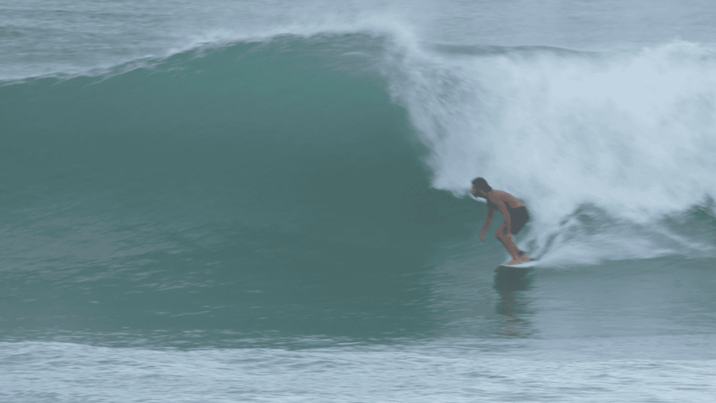
Mal País only works when the swell is big, I’d say over 6 feet. But because of the swell direction, the waves there come in a lot smaller than the swell size. So on a normal big day, Mal País is actually a good beginner spot. When the swell gets really big, it turns into an advanced wave.
You need to surf it from mid to high tide, too.

At low tide, the reef at Mal País is exposed and it’s basically unsurfable. Playa Carmen gets rocky at low tide as well. If you paddle out at the wrong time, you’re surfing over rocks. Check the tide first.
New to surfing? Start at Hermosa or Carmen with a coach. I compared every school in my surf lessons in Santa Teresa guide.
🏄 Your first waves
This is the top-rated surf class in town on Viator, with great reviews. A coach will pick the right beach and the right tide for you, which is half the battle here.
Where to Eat: Sodas, Casados and Weekly Deals
Food in Santa Teresa can get pricey fast. The trick is the sodas. A soda is a small local restaurant, and it’s the cheapest way to eat well here.
Order a casado. It’s the classic local plate: rice, beans, salad, sometimes fries, plus a piece of meat, chicken or fish. It usually costs about 5,000 to 6,000 colones, and it’s really good.
Here are the spots on my map, from north to south:
- Las Rosas: on Wednesdays they did 2-for-1 American burgers when I was there. You pay 8,000 colones, the price of one burger with fries, and you get two. Split it with a friend and it’s 4,000 each.
- Soda Tica Linda: the soda I ate at the most. It’s a bit cheaper than other sodas and the food is very, very good.
- Rico’s: homemade focaccia sandwiches. Delicious.
- Amici: live music and 6,000-colón pastas on Thursdays. It’s also my date-night pick. They had a deal for 15,000 colones: a 3-course meal for two with a glass of wine each. I haven’t tried that one yet, though.
Deals change, so walk the road
These were the deals while I was there. Deals change, and I don’t know if they run all season.
The best way to find deals is to walk down the main road and read the signs out front. Some places post on social media, but a lot of them don’t, so ask around.
ATMs and Banks in Santa Teresa
There are a few ATMs in town, but the fees are not the same. The BAC ATM in the middle of town charges you around $7 a withdrawal. That’s just the ATM fee. If you have a bank card from the United States or Europe, your own bank will usually add its fees on top.
I usually go to the Banco Nacional at the beginning of town, near the cruce. The fees there were lower for me.
If an ATM doesn’t give you your cash, check your bank app before you try again. Some travelers say an ATM charged them without giving them the money. Take a photo of the screen, and talk to the bank while you’re still in town.
Grocery Stores and Supermarkets
If you have a kitchen, cooking a few meals saves a lot of money. The biggest supermarkets are right at the cruce, where the roads to Cóbano, Mal País and Playa Carmen meet.
Super Ronny’s is usually the cheapest. There are two of them on the main road. Other supermarkets, like Diamond Supermarket, felt more expensive to me for the same product.
Anything imported is very expensive. So shop smart: buy local brands, local fruit and local coffee, and skip the imported cereal.
Getting Around: Scooter, ATV, Car or Walking
I got around on a scooter. It’s easier. In town the road is paved, so a scooter is all you need. If you want to explore north of Zeneidas toward Playa Hermosa and Manzanillo, an ATV is even better if you can afford it. Up there the road is unpaved, and it’s dusty or muddy depending on the weather.
Even if you’re just staying in town, it’s very hot here. Getting some kind of wheels, whether it’s a scooter, an ATV or a car, really changes your trip. You can get places fast without sweating your life off.
Cars work too, especially if you travel as a family or a group. Walking works if you stay central and only surf the main peaks. Otherwise, the distance between Playa Hermosa, the town center and Playa Carmen adds up fast in the heat.
My flat tire story
One night I got a flat tire on my scooter. The tire shop, Llantera Santa Teresa on the main road, closes at 10pm, and I rushed over right as he was about to close.
He was about to go home, but he stayed and fixed it for me instead. It cost me 5,000 colones, and the guy was super friendly the whole time. If you get a flat, that’s where I’d go.

The Dark Stretch: Santa Teresa at Night
North of Zeneidas, all the way up to Manzanillo, the road gets dark at night. There are some spots with street lights, but not many. That’s what makes it sketchy.
I wouldn’t go out there at night without friends or a good reason.
My after-party story
We went out there for an after-party one night. It was a bit sketchy, but it was fun. Then, while everyone was at the party, three scooters got stolen right from the party. Lock your wheels and keep the key on you.
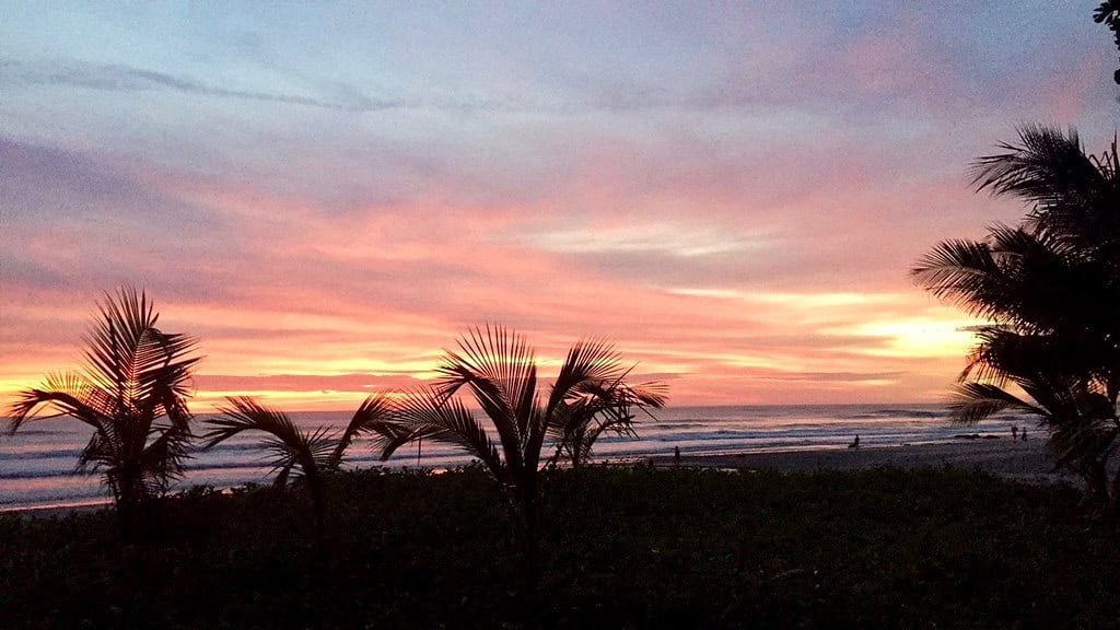
Overall, I feel safe in Santa Teresa. The ocean is the bigger risk. My honest take on all of it is in is Santa Teresa Costa Rica safe.
Where to Stay, Based on the Map
Use the map to pick your area first, then your bed. If you surf, stay central or in north Santa Teresa, close to La Lora and Zeneidas. Beginners can also stay near Playa Hermosa or Playa Carmen, close to the softer waves. My picks by area are in where to stay in Santa Teresa for surfers.
- On a budget: my best hostels in Santa Teresa list, from the beachfront dorm I stayed in for a month to the party hostels.
- Want everything sorted: I messaged 16 camps and compared the ones that replied in my surf camps in Santa Teresa post.
- Just browsing: see every Santa Teresa hostel on Hostelworld or all stays on Booking.com.

🌊 Where I stayed
I booked three nights at Zeneidas Surf Garden and stayed a month. It’s right on the beach, in front of its own peak, and a couple of minutes’ walk from the other main peaks.
Santa Teresa map cheat sheet
- Use the cruce as your landmark. Every direction you get starts from there.
- Save the map offline before you arrive, in case your signal drops.
- Check the tide before you pick a break. Carmen and Mal País get rocky at low tide.
- Pull cash at Banco Nacional to avoid the higher ATM fees.
- Shop at Super Ronny’s and skip imported brands.
- Walk the main road for deals. Many places only post them on a sign out front.
- Lock your scooter or ATV, especially north of Zeneidas at night.
- Got a flat? Llantera Santa Teresa on the main road fixed mine for 5,000 colones. It closes at 10pm.
Conclusion: Learn the Road and You Know the Town
Santa Teresa feels confusing for about a day. Then it clicks: one road, the beach on one side, the cruce at the bottom. Know where the breaks are, check the tide, and get some wheels. That’s most of it.
Save the map, grab the printable version if you want it offline, and if you’re still planning, start with my Santa Teresa surf guide. Heading somewhere else in the country? Here are the best surf spots in Costa Rica. Pura vida!
FAQs About the Santa Teresa Costa Rica Map
How is Santa Teresa, Costa Rica laid out?
Along one long main road that runs beside the beach. From north to south: Manzanillo, Playa Hermosa, Santa Teresa, then the cruce (T-intersection) at Playa Carmen, and Mal País to the south. The road to Cóbano starts at the cruce.
Which surf breaks in Santa Teresa are best for beginners?
Playa Hermosa and Playa Carmen from mid to high tide, and Manzanillo on any tide. Mal País is good for beginners too when a bigger swell is running, because the waves there stay smaller. Rocamar is for advanced surfers only.
Are there ATMs in Santa Teresa?
Yes. There’s a BAC ATM in the middle of town that charges about $7 a withdrawal, and a Banco Nacional near the cruce with lower fees.
Do I need a car in Santa Teresa?
Not really, but you need some wheels unless you stay central. A scooter is the easy option, and an ATV is better on the dirt road north of Zeneidas. A car works too.
Is it safe to walk around Santa Teresa at night?
In town, mostly yes. North of Zeneidas the road gets dark, so go with friends, bring a light and lock your scooter or ATV.
Is the Santa Teresa map free?
Yes. The map on this page is free. The printable version, the cheat sheet and my Google Map are free too, and I’ll send them by email.
